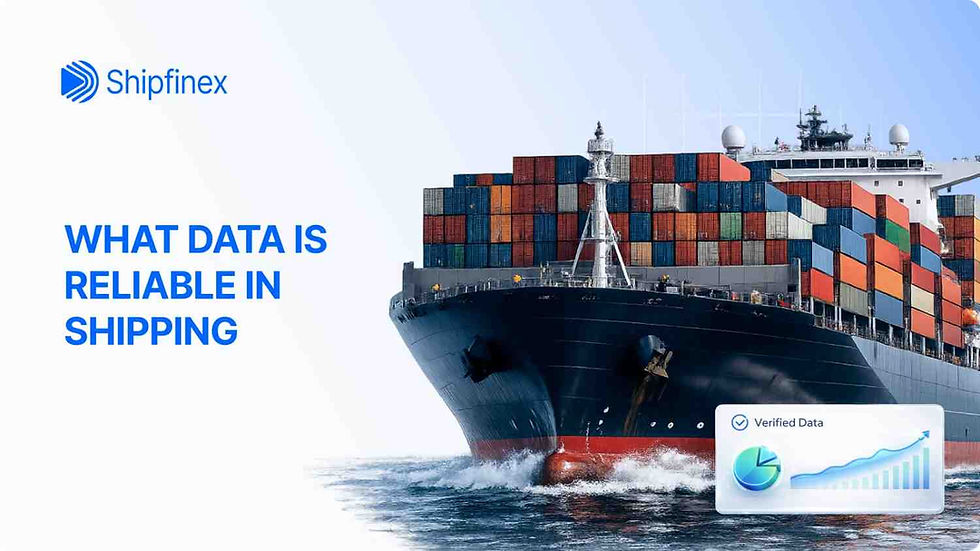
What Data Is Reliable in Shipping and What Isn't
- Dushyant Bisht

- 12 hours ago
- 9 min read
Key Takeaways
AIS provides highly accurate position, speed, and course data but unreliable destination, ETA, and cargo information
Classification society data ranks as most reliable for technical specifications, survey status, and ship condition verification
Port call data accuracy depends on source, with port authority records most reliable and AIS-derived data requiring cross-verification
Commercial data including charter rates and ship valuations requires skepticism and independent verification before business decisions
No single data source provides complete accuracy; cross-verification using multiple sources improves reliability
Understanding data limitations prevents misinterpretation and flawed operational or commercial decisions
Ships can manipulate or disable AIS, creating tracking gaps where position data becomes unavailable
Introduction
Multiple data sources track ship operations globally, from real-time position tracking to commercial fixture reports. Data quality and reliability vary significantly depending on the source, collection method, and reporting entity. Understanding which data types provide accurate information and which require verification prevents misinterpretation and flawed decision-making.
This analysis examines the primary maritime data sources, assesses their reliability levels, identifies common inaccuracies, and provides guidance on verification methods for evaluating ship operations.
AIS (Automatic Identification System)
The Automatic Identification System represents the most visible ship tracking technology, enabling real-time monitoring of ship movements globally. Understanding what AIS shows accurately versus what it shows unreliably matters for anyone using ship tracking data.
How AIS Works

AIS is a VHF radio-based system where ships broadcast their position, identification, speed, course, and navigational status. The system operates continuously, transmitting data every 2 to 10 seconds for ships underway and every 3 minutes for ships at anchor (1).
Shore-based receiving stations capture AIS signals from ships within VHF range, typically 20 to 40 nautical miles depending on antenna height and atmospheric conditions. Satellites equipped with AIS receivers capture signals from ships in ocean areas beyond terrestrial coverage, though with longer update intervals of 1 to 5 minutes due to satellite orbital patterns.
AIS transmits two types of data:
Static information (updated infrequently):
Ship name and call sign
IMO number (unique ship identifier)
Ship type and dimensions
Navigation status
Dynamic information (updated constantly):
GPS position (latitude/longitude)
Course over ground
Speed over ground
Heading
Rate of turn
The system is mandatory for international voyaging ships over 300 gross tons and all passenger ships regardless of size under SOLAS (Safety of Life at Sea) regulations (2). This makes AIS coverage comprehensive for commercial shipping, though smaller ships, fishing ships, and recreational craft may operate without AIS.
What AIS Data IS Reliable For

AIS provides highly accurate information for certain data types because they derive from objective electronic systems rather than manual input.
Current ship position: GPS-based position data is accurate within 10 to 100 meters depending on GPS receiver quality and satellite availability. This makes AIS excellent for determining where a ship is located at any given moment within coverage areas.
Movement patterns and routes: Historical AIS data shows actual routes ships traveled, port sequences visited, and operational patterns. This data is reliable because it reflects actual GPS tracks rather than declared intentions.
Speed and course information: Speed over ground and course over ground derive from GPS calculations and accurately represent the ship's actual movement. These metrics are reliable for understanding ship operations and performance.
Ship identification: IMO numbers assigned to ships provide unique identification that cannot change. Combined with ship name and call sign, AIS enables positive identification of specific ships, though name changes can create confusion if historical tracking doesn't update.
What AIS Data Is NOT Reliable For
Several AIS data fields depend on manual crew input or represent intentions rather than facts, making them frequently inaccurate.
Declared destination: Ships transmit their intended destination port as a text field manually entered by crew. This field updates infrequently, often remains set to a previous destination, or shows abbreviated codes that are ambiguous. A ship showing "SINGAPORE" might be heading to Singapore, transiting through Singapore to another destination, or have forgotten to update the field from a previous voyage.
Estimated Time of Arrival (ETA): ETAs are manually entered estimates that rarely account for weather delays, port congestion, speed adjustments, or routing changes. Ships commonly show ETAs that are days off from actual arrival times (3).
Cargo information: AIS does not transmit cargo details. The "cargo type" field shows only the general ship type (container ship, tanker, bulk carrier) based on static ship information, not what cargo is actually aboard.
Draught: Ships transmit current draught as a manually entered value. Crew may not update this field regularly, leading to inaccurate readings. While draught can indicate if a ship is laden or ballast (empty), the specific value often proves unreliable.
When AIS is turned off (dark ships): Ships can disable AIS transponders, either intentionally to avoid detection or due to equipment failure. AIS gaps create tracking blind spots. Ships sometimes go "dark" near politically sensitive areas, during sanction violations, or when transferring cargo at sea.
Spoofed or false AIS signals: Ships can manipulate transmitted data, broadcasting false positions or identities. While less common than simply turning off AIS, spoofing does occur in situations where ships want to conceal actual movements.
Classification Society Data
Classification societies maintain extensive technical records on ships they class, providing some of the most reliable maritime data available.
What Classification Societies Certify
Organizations like DNV, ABS, Lloyd's Register, Bureau Veritas, and ClassNK conduct detailed inspections and maintain records on:
Hull structural integrity and material specifications
Machinery type, capacity, and condition
Safety equipment installation and certification
Survey dates and compliance status
Technical drawings and modifications
Classification certificates confirm a ship meets specific construction and maintenance standards. These certificates are required for insurance coverage and commercial operations (4).
Reliability Level: High
Classification data ranks among the most reliable maritime information because:
Physical inspections verify technical specifications
Survey cycles enforce regular verification
Standards are internationally recognized
Documentation is maintained systematically
Economic consequences (loss of insurance, inability to trade) incentivize accuracy
Classification society records provide trustworthy data on ship age, type, dimensions, machinery specifications, and survey status. When evaluating a ship's technical condition, classification certificates and survey reports offer verified information rather than claimed capabilities.
How to Verify Classification Status
Classification societies provide verification services where interested parties can confirm a ship's current class status, survey dates, and certification standing. Most societies offer online verification portals where users can check if a ship remains in class and when the next survey is due.
Checking classification status before commercial transactions or charter agreements provides assurance that the ship maintains required standards and hasn't been suspended or withdrawn from class due to outstanding deficiencies.
Port Call Data
Port call records document ship arrivals and departures at commercial ports, though data sources and reliability vary.
Data Sources
Port call information comes from multiple sources with different accuracy levels:
Port authority records: Official records from port operators documenting actual arrival and departure times. These are generally accurate for timestamps and basic ship identification.
Agent reports: Ship agents file reports on behalf of ships calling at ports, providing commercial information on cargo operations, port activities, and services rendered. These reports are reasonably reliable for port-specific activities.
AIS-derived data: Many commercial tracking services determine port calls by analyzing AIS position data and identifying when ships enter defined port areas. This method provides broad coverage but can misidentify anchorages as port calls or miss short stops.
Accuracy Issues and Limitations
Port call data faces several reliability challenges:
Estimated versus actual times: Many sources publish estimated arrival times that may differ from actual arrivals by hours or days due to weather, congestion, or operational changes.
Data lag: Official port records may take days to publish after ships arrive or depart, creating delays between actual events and reported data.
Incomplete information: Not all ports publish comprehensive arrival/departure data publicly. Smaller ports or those in regions with limited digital infrastructure may have poor data availability.
Commercial versus operational data: Information about cargo loaded/discharged, services provided, or commercial arrangements often comes from agent reports or bills of lading rather than port authorities and may contain inaccuracies or commercial sensitivities affecting disclosure.
Cross-Verification Methods
Reliable port call analysis typically combines multiple sources:
AIS data for arrival/departure timing and geographic confirmation
Port authority records for official timestamps when available
Agent reports for commercial activity details
Bill of lading data for cargo verification
Single-source port call data should be treated as indicative rather than definitive, particularly for commercial analysis or contractual purposes.
Commercial Data Requiring Verification
Maritime commercial intelligence includes charter rates, ship valuations, and fixture reports that circulate through broker networks and maritime publications. This category of data requires the most skepticism and verification.
Charter Rate Reports
Reported charter rates come from broker assessments, market participants, and shipping publications. These reports indicate market levels but face accuracy challenges:
Confirmed versus rumored fixtures: Market reports distinguish between confirmed fixtures (verified by multiple sources) and rumored fixtures (unconfirmed reports). Rumored fixtures may be inaccurate regarding rate, duration, or even whether the fixture occurred.
Confidentiality and approximation: Actual charter parties (contracts) remain confidential between owners and charterers. Reported rates represent broker estimates or approximations rather than contracted terms. Actual rates may differ from published figures by 10 to 20 percent (5).
Options and variables: Charter contracts include numerous terms affecting effective rates including ballast bonuses, speed/consumption guarantees, port restrictions, and cargo types. Simplified rate reports may not capture these variables.
Ship Valuations
Ship valuations appear in broker reports, market assessments, and databases. These valuations vary significantly depending on methodology and purpose:
Broker estimates versus professional surveys: Broker desktop valuations provide market-level estimates based on recent comparable sales and current market conditions. Professional marine surveyor valuations involve physical inspections and detailed technical assessments. The two can differ by 20 to 40 percent depending on ship condition (6).
Market timing: Ship values fluctuate with freight market cycles. A valuation from a market peak may overstate current value if performed during a subsequent downturn.
Valuation purpose: Insurance valuations, sale and purchase valuations, and loan security valuations may use different methodologies and arrive at different figures for the same ship.
For accurate ship valuation, independent professional survey provides the most reliable assessment, while broker estimates serve as market indicators rather than precise values.
Fixture Reports

Fixture reports published in maritime press and broker circulars announce charter contracts between ship owners and cargo interests. These reports vary in reliability:
Reports from established broker firms with direct market involvement tend toward higher accuracy
Reports based on "market talk" or unverified sources often contain errors
Details may be deliberately obscured for commercial confidentiality
Corrections and updates may appear days later when initial reports prove inaccurate
Using fixture reports for market trend analysis works better than relying on individual fixture details for commercial decisions.
Conclusion
Maritime data sources vary dramatically in reliability depending on collection method, verification processes, and incentives affecting accuracy. AIS provides excellent tracking for ship positions and movements but poor data for destinations and commercial details. Classification society records offer verified technical information, while commercial intelligence requires careful verification.
Effective maritime analysis combines multiple data sources, understands each source's limitations, and applies appropriate skepticism to unverified claims. Position data, technical certificates, and official port records provide the most reliable foundation, while commercial reports and user-entered fields require cross-verification before informing decisions. Understanding these distinctions enables accurate assessment of ship operations and maritime market conditions.
Frequently Asked Questions
What is AIS ship tracking?
AIS (Automatic Identification System) is a tracking system where ships broadcast their position, speed, course, and identification via VHF radio. Shore stations and satellites receive these signals, enabling real-time ship tracking. AIS is mandatory for commercial ships over 300 gross tons internationally and all passenger ships.
How accurate is AIS data?
AIS position data is generally accurate within 10-100 meters depending on GPS quality and satellite/terrestrial coverage. However, declared destination, cargo information, and estimated arrival times are user-entered and often inaccurate. Ships can also turn off AIS or transmit false information.
What is real-time AIS?
Real-time AIS provides current ship positions updated every few seconds to minutes depending on ship speed and movement. Satellite AIS covers ocean areas where terrestrial stations cannot receive signals, though with slightly longer update intervals (typically 1-5 minutes versus 2-10 seconds for terrestrial).
What shipping data can I trust?
Most reliable data includes classification society certificates (surveys, technical specs), official port authority arrival/departure records, and GPS-based AIS position data. Least reliable includes user-entered AIS fields (destination, ETA), broker valuations without surveys, and unconfirmed charter rate reports.
Can ships turn off AIS?
Yes, ships can disable AIS transponders either intentionally or due to equipment failure. While regulations require AIS operation, ships sometimes go "dark" near politically sensitive areas, during sanction violations, or when concealing movements. AIS gaps create tracking blind spots.
How do I verify ship information?
Cross-verify using multiple sources: AIS for position/movement, classification society records for technical specs, port authority records for arrival/departure, and independent surveys for valuations. No single source provides complete accuracy; triangulation improves reliability.
COMPLIANCE DISCLAIMER:
This content is for informational and educational purposes only. It does not constitute technical, operational, or commercial advice. Data reliability varies by source, timing, and verification methods. Maritime data users should conduct independent verification and consult qualified maritime professionals for operational or commercial decisions. Past data accuracy does not guarantee future reliability.


Dushyant Bisht
Expert in Maritime Industry
Dushyant Bisht is a seasoned expert in the maritime industry, marketing and business with over a decade of hands-on experience. With a deep understanding of maritime operations and marketing strategies, Dushyant has a proven track record of navigating complex business landscapes and driving growth in the maritime sector.
Email: [email protected]


